
Cerro Masatrigo (Badajoz)
Barra lateral del artículo
Contenido principal del artículo
Resumen
Fotografia finalista Concurso de Fotografía de la Asociación Española de Geografía
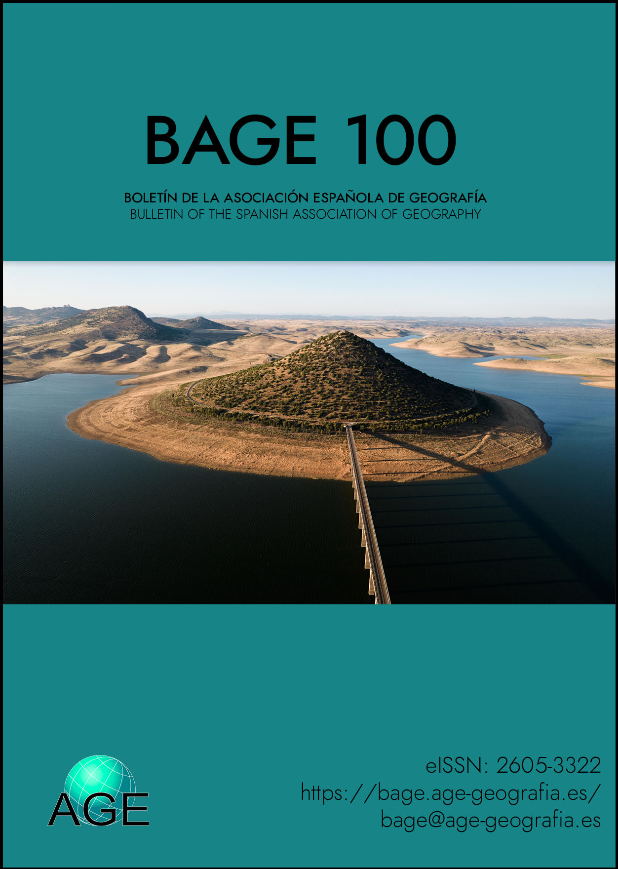
La fotografía, tomada desde un dron, muestra el Cerro Masatrigo, una colina que quedó rodeada por las aguas de la presa de La Serena (que en su momento fue la más grande de la Península Ibérica).
Se encuentra ubicada en el término municipal de Esparragosa de Lares y su cota es de 501 metros sobre el nivel del mar. Destaca su forma cónica, muy conocida porque la rodea la carretera EX-322 que, a la salida del Puente, se bifurca en dos ramales que rodean este cerro. También existen rutas senderistas para subir al mirador que se encuentra en la cima.
Coordenadas: 38°56′04′′N 5°12′22′′O
The photograph, taken from a drone, shows Cerro Masatrigo, a hill that was surrounded by the waters of the La Serena dam (which at the time was the largest in the Iberian Peninsula).
It is located in the municipality of Esparragosa de Lares and its height is 501 meters above sea level. Its conical shape stands out, well known because it is surrounded by the EX-322 road that, at the exit of the bridge, forks into two branches that surround this hill. There are also hiking trails to climb to the viewpoint at the top.
Coordinates: 38°56′04′′N 5°12′22′′O
Detalles del artículo
Número
Sección

Esta obra está bajo una licencia internacional Creative Commons Atribución-NoComercial 4.0.